

Key Takeaways
- Highway 1 is frequently closed or narrowed by landslides, especially in winter and spring months.
- The full California coastal route is around 650 miles and realistically takes five or more days to drive meaningfully.
- Many iconic stops are heavily visited and require advance reservations or timed entry permits.
- Cell service is unreliable across large stretches — offline maps and a paper backup are practical necessities.
- The drive rewards patience and flexibility more than rigid itineraries.
Scenery that genuinely justifies the hype
The Big Sur coastline offers some of the most dramatic land-meets-ocean terrain in the continental US. Viewpoints like Bixby Creek Bridge and McWay Falls are photographed constantly because they're genuinely extraordinary.
Rich ecological variety along the route
The corridor includes elephant seal viewing at Piedras Blancas, coastal redwood groves, tide pools, and migrating whale sightings — all accessible from the road or short walks.
Flexibility to set your own pace
Unlike most US road trips, Highway 1 rewards spontaneous stops. Pulling over at an unmarked overlook often yields views equal to designated viewpoints without the crowds.
Accessible from major California cities
The route connects easily from San Francisco in the north and Los Angeles in the south, making it workable as a standalone trip or as a leg within a broader California itinerary.
Quieter northern sections are genuinely undervisited
The Sonoma and Mendocino coast segments north of San Francisco draw far fewer visitors than Big Sur while offering comparable coastal beauty and more open road.
Road closures are frequent and sometimes prolonged
Landslides and storm damage regularly close sections of Highway 1, particularly through Big Sur. Some closures have lasted a year or more, requiring lengthy inland detours via Highway 101.
Iconic stops are crowded and heavily managed
Popular viewpoints require timed-entry reservations, and parking lots at sites like Julia Pfeiffer Burns State Park fill well before noon on weekends. Spontaneous visits to headliner stops are often not possible.
Narrow lanes demand sustained concentration
The Big Sur stretch has minimal shoulders, blind curves, and significant drops. Drivers unaccustomed to narrow mountain roads — particularly in larger vehicles — often find the drive stressful rather than relaxing.
Cell and data service is largely absent
Much of the route between Carmel and San Luis Obispo has no reliable mobile signal. This affects navigation, emergency contact, and travel app access for extended periods.
Accommodation options are limited and expensive in Big Sur
Lodging within Big Sur itself is scarce, and rates at available properties reflect the lack of competition. Most travelers base themselves in Carmel, Monterey, or San Luis Obispo and drive in.
Fuel stops are infrequent and costly in remote sections
Gas stations are sparse through Big Sur, and prices at those that exist can run significantly above California's already high average. Starting each day with a full tank is a practical necessity.
Our Verdict
Highway 1 delivers on its scenic reputation in ways few US road trips can match — but it punishes drivers who approach it like a highway. Closures, narrow lanes, slow-moving traffic, and oversaturated viewpoints are all part of the reality. Travelers who build in buffer days and approach the route with genuine curiosity tend to find it worthwhile; those expecting a smooth, efficient coastal cruise often leave frustrated.
Ideal for flexible travelers who prioritize scenery and experience over speed, and who are prepared to adapt when road conditions or closures change their plans.
What Highway 1 Actually Is (and Isn't)
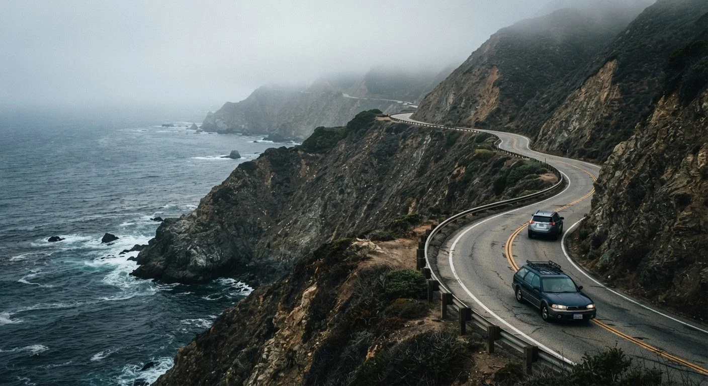
California's Highway 1 — often called the Pacific Coast Highway, though that name technically refers to a separate designation — runs roughly 650 miles along the state's coastline. The most celebrated segment is the Big Sur stretch between San Luis Obispo and Carmel, where cliffs drop sharply into the ocean and the road narrows to two lanes with no shoulder and no guardrail in some sections.
What it isn't: a fast route. Average speeds through Big Sur hover around 25–35 mph when traffic is light, and significantly slower when RVs, cyclists, or tourist pullouts back things up. Drivers who expect an open, flowing coastal cruise — the kind seen in car commercials — are often surprised by how technically demanding and stop-and-start the drive actually is. The techniques and awareness required for narrow rural roads are genuinely different from motorway driving, and Highway 1 sits firmly at the demanding end of that spectrum.
The Pros: Why This Drive Has Earned Its Reputation
Despite the caveats, Highway 1 earns its iconic status for real reasons. The scenery across the Big Sur coast is legitimately extraordinary — sheer cliffs, sea-stack rock formations, elephant seal rookeries, and redwood groves all within a single corridor.
Scenery that genuinely justifies the hype
The Big Sur coastline offers some of the most dramatic land-meets-ocean terrain in the continental US. Viewpoints like Bixby Creek Bridge and McWay Falls are photographed constantly because they're genuinely extraordinary.
Rich ecological variety along the route
The corridor includes elephant seal viewing at Piedras Blancas, coastal redwood groves, tide pools, and migrating whale sightings — all accessible from the road or short walks.
Flexibility to set your own pace
Unlike most US road trips, Highway 1 rewards spontaneous stops. Pulling over at an unmarked overlook often yields views equal to designated viewpoints without the crowds.
Accessible from major California cities
The route connects easily from San Francisco in the north and Los Angeles in the south, making it workable as a standalone trip or as a leg within a broader California itinerary.
Quieter northern sections are genuinely undervisited
The Sonoma and Mendocino coast segments north of San Francisco draw far fewer visitors than Big Sur while offering comparable coastal beauty and more open road.
Beyond aesthetics, the route offers genuine variety. Northern sections near Bodega Bay and Point Reyes feel wilder and less visited than the central stretch. Stopping for even 20 minutes at a lesser-known pullout often reveals coastline that feels entirely private.
The Cons: What Trip Reports Don't Always Mention
Honest accounts of Highway 1 tend to gloss over the friction points. Understanding these before you go is what separates a well-planned trip from a frustrating one.
Road closures are frequent and sometimes prolonged
Landslides and storm damage regularly close sections of Highway 1, particularly through Big Sur. Some closures have lasted a year or more, requiring lengthy inland detours via Highway 101.
Iconic stops are crowded and heavily managed
Popular viewpoints require timed-entry reservations, and parking lots at sites like Julia Pfeiffer Burns State Park fill well before noon on weekends. Spontaneous visits to headliner stops are often not possible.
Narrow lanes demand sustained concentration
The Big Sur stretch has minimal shoulders, blind curves, and significant drops. Drivers unaccustomed to narrow mountain roads — particularly in larger vehicles — often find the drive stressful rather than relaxing.
Cell and data service is largely absent
Much of the route between Carmel and San Luis Obispo has no reliable mobile signal. This affects navigation, emergency contact, and travel app access for extended periods.
Accommodation options are limited and expensive in Big Sur
Lodging within Big Sur itself is scarce, and rates at available properties reflect the lack of competition. Most travelers base themselves in Carmel, Monterey, or San Luis Obispo and drive in.
Fuel stops are infrequent and costly in remote sections
Gas stations are sparse through Big Sur, and prices at those that exist can run significantly above California's already high average. Starting each day with a full tank is a practical necessity.
The realities of heavily visited destinations apply acutely here: viewpoints like Bixby Creek Bridge are genuinely spectacular, but they're also genuinely crowded. Arriving at 7 a.m. versus 11 a.m. can mean the difference between a contemplative stop and a parking standoff.
650 mi
Approximate full length of California's Highway 1
The route stretches from Dana Point in Orange County to Leggett in Mendocino County, with the Big Sur segment being the most challenging and visited.
~1 year
Duration of a major Big Sur closure after 2017 landslide
The Mud Creek landslide in May 2017 deposited millions of cubic yards of debris, closing a key Big Sur segment for approximately 14 months.
Planning Logistics That Actually Matter
A few practical considerations have an outsized impact on how the trip goes:
- Check closure status before departure. Caltrans maintains a road conditions dashboard, and Big Sur closures — particularly around Pfeiffer Canyon and Mud Creek — have been significant and sometimes lasted months. Verifying the route is open end-to-end before you leave saves real disruption.
- Book McWay Falls, Julia Pfeiffer Burns, and similar day-use areas in advance. California State Parks' reservation system requires timed entry for several popular sites; walk-up access is not guaranteed, particularly on weekends.
- Plan for 200–300 miles per day, not more. On Highway 1, 150 miles can take six hours with stops. Overloading daily mileage targets is the most common driver of trip dissatisfaction.
- Download offline maps before entering Big Sur. Cell and data service disappears for long stretches. Relying on live navigation creates real problems when a route change or detour becomes necessary.
Verify Current Road Conditions Before You Leave
Caltrans provides updated road condition and closure information through its official website and the QuickMap tool. Conditions on Highway 1 can change rapidly after rain events or wildfires. Always check the most current status within 24 hours of departure, and identify your inland alternate route (typically US-101) before you need it. For entry-required state parks, check the California State Parks reservation system directly — availability and requirements change seasonally.
When to Go — and What That Really Means
Late spring (May–June) and early fall (September–October) are widely considered the most favorable windows: fewer closures than winter, lower wildfire risk than peak summer, and temperatures that make stopping and walking comfortable. Summer draws the heaviest crowds, particularly on weekends from the Bay Area and Los Angeles.
Fog is a year-round feature of the California coast, not an aberration. Marine layer frequently rolls in overnight and doesn't lift until late morning — sometimes not at all. Planning to drive the most scenic segments in the afternoon, when skies are more likely to be clear, improves visibility without requiring any particular luck. Accept that some days will be gray, and that fog-shrouded coastline has its own atmosphere worth experiencing.